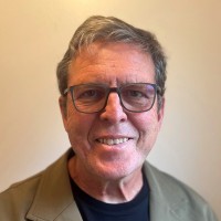
AeroLeads people directory · profile
Robert Stallard Email & Phone Number
Research Hydrologist and Biogeochemist Emeritus
at
U.S. Geological Survey (USGS)
3 work emails found
@usgs.gov
3 phones found area 703 and 785
LinkedIn matched
✓ Verified August 2026
4 data sources
Profile completeness 100%
Current company
Role
Research Hydrologist and Biogeochemist Emeritus
Location
Boulder, Colorado, United States
Company size
Who is Robert Stallard? Overview
A concise factual answer block for searchers comparing this professional profile.
Quick answer
Robert Stallard is listed as Research Hydrologist and Biogeochemist Emeritus at U.S. Geological Survey (USGS), a with 8032 employees, based in Boulder, Colorado, United States. AeroLeads shows a work email signal at usgs.gov, phone signal with area code 703, 785, and a matched LinkedIn profile for Robert Stallard.
Robert Stallard previously worked as Research Hydrologist / Biogeochemist Emeritus at U.S. Geological Survey (Usgs) and Research Hydrologist / Biogeochemist at U.S. Geological Survey (Usgs). Robert Stallard holds Post Doctoral Research, Clay Mineralogy from U.S. Geological Survey Office Of Marine Geology, Woods Hole, Massachusetts.
Company email context
Email format at U.S. Geological Survey (USGS)
This section adds company-level context without repeating Robert Stallard's masked contact details.
{first_initial}{last}@usgs.gov
95% confidence
AeroLeads found 3 current-domain work email signals for Robert Stallard. Compare company email patterns before reaching out.
Profile bio
About Robert Stallard
I am a research hydrologist and biogeochemist working at the University of Colorado, Boulder, the Smithsonian Tropical Research Institute, Panama, and Scientist Emeritus at the US Geological Survey, Boulder (my paid position for many years). I study the earth-surface environment and how it changes on human and geologic time scales, focusing on climate and land-use changes and how these affect processes that control the composition and dispersal of dissolved and solid phases in rivers and trace gases in the atmosphere. I have worked in natural and human-altered landscapes, in the Americas, Southeast Asia, and Africa, including most of the Amazon, Orinoco, Mississippi and Panama Canal Basins and Puerto Rico. I have pioneered the linking of the composition of river-borne materials to the geology, soils, landscape, vegetation, land use, and climate change through field observations and through the development of steady-state erosional models that relate the composition of solid and dissolved erosion products. I broke new ground in the analysis of soil erosion, nutrient loading, and terrestrial sedimentation in human-altered carbon and nutrient cycles. Other interests include designing techniques to rapidly assess remote tropical landscapes for research and conservation.
Listed skills include Field Work, Environmental Science, Science, Water Quality, and 11 others.
Current workplace
Robert Stallard's current company
Company context helps verify the profile and gives searchers a useful next step.
U.S. Geological Survey (Usgs)
7 roles
Robert Stallard work experience
A career timeline built from the work history available for this profile.
Research Hydrologist / Biogeochemist Emeritus
CurrentResearch focused on the effects of land-use change on geomorphic and biogeochemical processes that control the chemistry of solid and dissolved phases in rivers, including interlinked, multidisciplinary studies of weathering, erosion, biogeochemical cycling, atmospheric-gas exchange, and land use.
Aug 2019 - Present
Research Hydrologist / Biogeochemist
Research focused on the effects of land-use change on geomorphic and biogeochemical processes that control the chemistry of solid and dissolved phases in rivers, including interlinked, multidisciplinary studies of weathering, erosion, biogeochemical cycling, atmospheric-gas exchange, and land use.My basic research program focuses on the use of natural and altered landscapes to understand the regional effects of land-cover change. Over the years, work has been split among several projects that involve research into near-earth-surface biogeochemical processes on Pleistocene to technological time scales. Since 1990, I have organized and have led two large, interlinked, multidisciplinary studies concerned with the land-use change. One project is part of the USGS Water, Energy, and Biogeochemical Budgets (WEBB) Project in eastern Puerto Rico and parallel work in central Panama funded by the Smithsonian Tropical Research Institute (STRI). The other project was the Inter-Divisional “Carbon Project” which ran from 1993 to 2004 as the “Mississippi Basin Carbon Project” (MBCP).
Oct 1987 - Jul 2019

Research Associate
CurrentFor the last 20+ years I have used knowledge gained from studies of intensely studied watersheds to develop simple but reliable techniques to rapidly assessment of hydrologic and biogeochemical conditions in remote, pristine ecosystems. My focus has been tropical, and while the initial work was in Panama, since 2004, I have worked with the Science Action for Conservation & Community Program of the Chicago Field Museum, now the Amazon and Andes Program, to rapidly inventory and assess remote landscapes in western Amazon and Guyana. The purpose of these inventories is to promote conservation, and we apply rigorous biological, social, and now earth-science observations to understand landscapes and to present this knowledge so that it is accessible to non-scientists, including members of indigenous tribes, with whom we are working, local conservationists, and government policy makers. Each inventory is run as a multi-week field campaign to remote and minimally described regions that are of great conservation value and require characterization to be placed into a protected status.This work has been remarkably successful; in the ten inventories with which I have been directly involved, 35,128 km2 of rainforest has been protected, almost four times the area of Yellowstone National Park. Most recently, Yaguas National Park, Peru, created in January 2018, came out of this work; it alone is the size of Yellowstone National Park. Although I work as a volunteer, these campaigns have contributed powerfully to my research interests relating landscape to natural land cover. My last Inventory, completed just before COVID-19 ended such fieldwork, was Rapid Inventory 31 of the lower Putumayo, Yaguas, and Cotuhé Rivers in both Peru and Colombia. I am currently working on developing a study of the Rupununi Portal in Guyana
Jul 2013 - Present
Research Scientist
CurrentThe Agua Salud Project is a basic-science ecosystem-service project focused on the role of different types of reforestation as a means of removing carbon dioxide from the atmosphere. The results will have significant impact on management and conservation in steepland landscapes in the humid seasonal tropics. With proposals to plant of trees to sequester substantial anthropogenic carbon, there is a conflict between water availability and carbon sequestration. According to Jackson et al. (2005, Trading water for carbon with biological sequestration, Science, v. 310, p. 1944-1947), older forests reduce annual runoff by 150-600 mm compared to adjacent lands (for the Agua Salud forests, this is more than 500 mm). We have more than 10 years of data. The Agua Salud project is attracting research groups that are studying hydrology, carbon and nutrient cycling, biodiversity, microbial biology, and ecosystem-services studies. Our principal field site includes the Río Agua Salud watershed and the headwaters of several adjacent rivers in the central Isthmus of Panama, east of the Panama Canal. The region encompasses both protected mature forests and a wide variety of land uses that are typical of rural Panama. Reforestation experiments at the scale of entire catchments, ranging from 6 to 180 ha in area, permit complete water and carbon inventories and exchanges for different land uses. There are five experimental treatments: native-species plantation, monoculture teak plantation (supplemented with native species after 7 years), native secondary succession, silvo-pastoral, and deforestation. There are four different control catchments: mature forest, grazed pasture, tropical agricultural mosaic, and a catchment covered by a monoculture of invasive canal grass (Saccharum spontaneum). Controls serve to distinguish between effects of tree growth and interannual-climate variation.
Jan 2004 - Present
Research Scientist Iii, Professor Adjoint
Current
University Of Colorado Boulder, Instaar
The University of Colorado, INSTAAR has provided me with a platform upon which I can include graduate students and undergraduates in my research projects at the U.S. Geological Survey and the Smithsonian Tropical Research Institute. Spread across these projects, I currently work in four broad themes: (A) continental-scale biogeochemistry, (B) nutrient-carbon-cycle research, (C) event-related hydrology and biogeochemistry, and (D) source-region controls on hydrology, biogeochemistry, and vegetation in tropical to glacial landscapes. My most active initiative, the Agua Salud Project (ASP) examines ecosystems services of forests as compared to other land used in the central Panama Canal Watershed, currently funded through the Smithsonian Tropical Research Institute.
Sep 1998 - Present
Assistant Professor
Princeton University, Department Of Geological And Geophysical Sciences
Research involved low-temperature geochemistry, emphasizing relating geomorphic and biologic processes to the chemistry of solid and dissolved phases in rivers and soils. Principal investigator for seven funded projects. Major advisor for seven Ph.D. and seventeen B.A./B.S.E. students.
Jul 1981 - Sep 1987
Team & coworkers
Colleagues at U.S. Geological Survey (USGS)
Other employees you can reach at usgs.gov. View company contacts for 8032 employees →
LA
 Larry Allain
Colleague at U.S. Geological Survey (Usgs)Lafayette, Louisiana, United States
View →
CA
Larry Allain
Colleague at U.S. Geological Survey (Usgs)Lafayette, Louisiana, United States
View →
CA
 Clinton Allen
Colleague at U.S. Geological Survey (Usgs)Fort Belvoir, Virginia, United States
View →
GR
Clinton Allen
Colleague at U.S. Geological Survey (Usgs)Fort Belvoir, Virginia, United States
View →
GR
 Gail Rogall
Colleague at U.S. Geological Survey (Usgs)Madison, Wisconsin, United States
View →
RP
Gail Rogall
Colleague at U.S. Geological Survey (Usgs)Madison, Wisconsin, United States
View →
RP
 Ryker Pedde
Colleague at U.S. Geological Survey (Usgs)Greater Sioux Falls Area, United States
View →
JJ
Ryker Pedde
Colleague at U.S. Geological Survey (Usgs)Greater Sioux Falls Area, United States
View →
JJ
 Jessica Jacobs
Colleague at U.S. Geological Survey (Usgs)St Petersburg, Florida, United States
View →
EM
Jessica Jacobs
Colleague at U.S. Geological Survey (Usgs)St Petersburg, Florida, United States
View →
EM
 Emily Martin
Colleague at U.S. Geological Survey (Usgs)Golden, Colorado, United States
View →
JW
Emily Martin
Colleague at U.S. Geological Survey (Usgs)Golden, Colorado, United States
View →
JW
 Jay Wellik
Colleague at U.S. Geological Survey (Usgs)Portland, Oregon Metropolitan Area, United States
View →
DF
Jay Wellik
Colleague at U.S. Geological Survey (Usgs)Portland, Oregon Metropolitan Area, United States
View →
DF
 Dan F
Colleague at U.S. Geological Survey (Usgs)Hilliard, Ohio, United States
View →
KE
Dan F
Colleague at U.S. Geological Survey (Usgs)Hilliard, Ohio, United States
View →
KE
 Kathryn E. Watts
Colleague at U.S. Geological Survey (Usgs)Spokane, Washington, United States
View →
TR
Kathryn E. Watts
Colleague at U.S. Geological Survey (Usgs)Spokane, Washington, United States
View →
TR
 Teresa Rasmussen
Colleague at U.S. Geological Survey (Usgs)Lawrence, Kansas, United States
View →
Teresa Rasmussen
Colleague at U.S. Geological Survey (Usgs)Lawrence, Kansas, United States
View →
Larry Allain
Colleague at U.S. Geological Survey (Usgs)Lafayette, Louisiana, United States
View →
CA
Clinton Allen
Colleague at U.S. Geological Survey (Usgs)Fort Belvoir, Virginia, United States
View →
GR
Gail Rogall
Colleague at U.S. Geological Survey (Usgs)Madison, Wisconsin, United States
View →
RP
Ryker Pedde
Colleague at U.S. Geological Survey (Usgs)Greater Sioux Falls Area, United States
View →
JJ
Jessica Jacobs
Colleague at U.S. Geological Survey (Usgs)St Petersburg, Florida, United States
View →
EM
Emily Martin
Colleague at U.S. Geological Survey (Usgs)Golden, Colorado, United States
View →
JW
Jay Wellik
Colleague at U.S. Geological Survey (Usgs)Portland, Oregon Metropolitan Area, United States
View →
DF
Dan F
Colleague at U.S. Geological Survey (Usgs)Hilliard, Ohio, United States
View →
KE
Kathryn E. Watts
Colleague at U.S. Geological Survey (Usgs)Spokane, Washington, United States
View →
TR
Teresa Rasmussen
Colleague at U.S. Geological Survey (Usgs)Lawrence, Kansas, United States
View →
3 education records
Robert Stallard education
Post Doctoral Research, Clay Mineralogy
U.S. Geological Survey Office Of Marine Geology, Woods Hole, Massachusetts
Doctor Of Philosophy - Phd, Geochemistry
Massachusetts Institute Of Technology - Woods Hole Oceanographic Institution Joint Program
Bachelor Of Science - Bs, Earth And Planetary Sciences
FAQ
Frequently asked questions about Robert Stallard
Quick answers generated from the profile data available on this page.
What company does Robert Stallard work for?
Robert Stallard works for U.S. Geological Survey (USGS).
What is Robert Stallard's role at U.S. Geological Survey (USGS)?
Robert Stallard is listed as Research Hydrologist and Biogeochemist Emeritus at U.S. Geological Survey (USGS).
What is Robert Stallard's email address?
AeroLeads has found 3 work email signals at @usgs.gov for Robert Stallard at U.S. Geological Survey (USGS).
What is Robert Stallard's phone number?
AeroLeads has found 3 phone signal(s) with area code 703, 785 for Robert Stallard at U.S. Geological Survey (USGS).
Where is Robert Stallard based?
Robert Stallard is based in Boulder, Colorado, United States while working with U.S. Geological Survey (USGS).
What companies has Robert Stallard worked for?
Robert Stallard has worked for U.S. Geological Survey (Usgs), Field Museum, Smithsonian Tropical Research Institute, University Of Colorado Boulder, Instaar, and Princeton University, Department Of Geological And Geophysical Sciences.
Who are Robert Stallard's colleagues at U.S. Geological Survey (USGS)?
Robert Stallard's colleagues at U.S. Geological Survey (USGS) include Larry Allain, Clinton Allen, Gail Rogall, Ryker Pedde, and Jessica Jacobs.
How can I contact Robert Stallard?
You can use AeroLeads to view verified contact signals for Robert Stallard at U.S. Geological Survey (USGS), including work email, phone, and LinkedIn data when available.
What schools did Robert Stallard attend?
Robert Stallard holds Post Doctoral Research, Clay Mineralogy from U.S. Geological Survey Office Of Marine Geology, Woods Hole, Massachusetts.
What skills is Robert Stallard known for?
Robert Stallard is listed with skills including Field Work, Environmental Science, Science, Water Quality, Hydrology, Ecology, Geology, and Arcgis.
Find 750M verified contacts
Search by job title, company, industry, location, and seniority. Export verified B2B contact data when you need it.
Start free trialPeople with similar names
Check these profiles if this is not the Robert Stallard you were looking for.
Robert Stallard
3 email domains
Robert Stallard
2 email domains
Robert Stallard
3 email domains

Robert Stallard
3 email domains