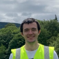
Geographic Information Systems Technician
CurrentAs a member of the GIS team, I have worked on several projects for the Department of Agriculture, Food and the Marine including the Basic Payment Scheme Updates, ACRES (Agri-Climate Rural Environmental Scheme) and on the Forestry mapping project. These projects entail analyses of orthophotography and satellite images to accurately digitise plots for area-based schemes. Additionally, I am also a member of the Quality Control team helping to ensure high quality digitising by providing timely feedback. I have also worked on the Earth Observation team analysing NDVI (normalised difference vegetation index) images to identify artificial features in land parcels.Through this role, I have gained a greater understanding of the Common Agricultural Policy regulations, have become proficient in the LPIS ( Land Parcel Identification System) software and developed accurate digitising techniques.