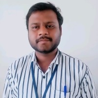
AeroLeads people directory · profile
Vasantha Kumar M Email & Phone Number
GIS ( EIA) Consultant
at
Self-employed
LinkedIn matched
✓ Verified July 2026
3 data sources
Profile completeness 86%
Who is Vasantha Kumar M? Overview
A concise factual answer block for searchers comparing this professional profile.
Quick answer
Vasantha Kumar M is listed as GIS ( EIA) Consultant at Self-employed, based in Chennai, Tamil Nadu, India. AeroLeads shows a matched LinkedIn profile for Vasantha Kumar M.
Vasantha Kumar M previously worked as Geographic Information Systems Consultant at Self-Employed and Project Manager at Rsi Softech India Pvt Ltd. Vasantha Kumar M holds M.Sc, Environmental Remote Sensing from Madurai Kamraj University, Madurai.
Company email context
Email format at Self-employed
This section adds company-level context without repeating Vasantha Kumar M's masked contact details.
Self-employed
Review company-level records connected to Vasantha Kumar M before choosing the right outreach path.
Profile bio
About Vasantha Kumar M
Having 15+ years of experience in Remote Sensing GIS applications in natural resources management, rural & urban development and EIA projects. Worked as a GIS Expert for AMRUT/SMART CITY projects - Tamil Nadu, INDIA
Current workplace
Vasantha Kumar M's current company
Company context helps verify the profile and gives searchers a useful next step.
6 roles · 13 years
Vasantha Kumar M work experience
A career timeline built from the work history available for this profile.
Geographic Information Systems Consultant
Self-Employed
Drone based topographical surveyMining SurveyDGPS surveyLanduce / Landcover Mapping
Project Manager
• Overall team monitoring as per the agreed project plan for executing the assignment within the period of 6 months Interaction & communication with the SIPCOT.• Coordinate team resources, processes, project schedule and engage subcontractors to support project deliver Programs.• Lead technical discussions with Clients.• Provides GIS‐related technical guidance and assistance to project teams.• Reporting to the SIPCOT and for reviews. Random QC of Survey and digitized data.
Sep 2020 - Apr 2022
Assistant Vice President
Darashaw And Company Pvt. Ltd
- Monitoring & Updating the status of implementation of AMRUT & Smart Cities Mission funded projects.- Preparing Request for Proposal (RFP) for SMART CITY Projects., - Preparing EOI for inviting proposal from various bidders - Evaluate the proposals and prepare a short-list of potential bidders capable of participating in the projects. -Detailed Project Report: -The key focus of the study is to identify the tourism infrastructure gaps in the tourist locations. - Analysis of infrastructure facilities available- Bid Process Management assignments for various public sector organizations including urban local bodies, TamilNadu.- Coordinated with all Smart Cities in Tamil Nadu and collect necessary details and entered the Data in the Government of India portal.- Solid Waste Management - Capacity Building of Municipal Staff – Study Tours /Exposure Visits for Elected Representatives and Officials of ULBs.
Apr 2015 - Jun 2020
Gis Consultant
Free Lance Lu/Lc
Around 110 Nos. of projects completed related to Landuse \ landcover studies for Environmental Impact Assessment (EIA) for different user agencies.Some Major Consultancy Projects:1.Study on surface features of Neyveli mine area using satellite data.- Sponsored by M/s. Neyveli Lignite Corporation Neyveli.2.Preparation of land use , land cover map at cadastral level for Highwavys,Theni.- Sponsored by M/s. Collectorate Theni.3.Landuse / Landcover Map For 7km Buffer From High Tide Line Of The Union Territory Of DAMAN. - Sponsored by M/s. The Member Secretary, Daman And Diu, Coastal Zone Management Authority, Daman.4.Landuse / Landcover Map For 7km Buffer From High Tide Line Of The Union Territory Of DIU . -Sponsored by M/s. The Member Secretary, Daman and Diu, Coastal Zone Management Authority,DIU
2014 - Mar 2015

Sr. Project Associate
1. Desertification Status Mapping Of India – (Second Cycle) - (Space Applications Centre, Ahmedabad )2. Application of Remote Sensing & GIS in Sericulture Development in State of Tamil Nadu - (North Eastern Space Applications Centre (NESAC), Umiam (Meghalaya) )3. Preparation of Digitized Local Level Coastal Zone Management Plans (CZMPS) for coastal areas with Cadastral Information for Greater Mumbai, Raigad & Ratnagiri Districts of Maharashtra (Maharashtra Coastal Zone Management Authority)4. Rajiv Gandhi National Drinking Water Mission Project - (Department of Drinking Water Supply, MoRD, Govt. of India, NRSC, Hyderabad)5. Preparing a High Tide Line /Low Tide Line on Cadastral map for the entire coastal stretch of Tamil Nadu - (Dept. of Environment, Government of Tamil Nadu)6. Study of near coastal circulation using satellite data and an Indian Ocean dynamic model - (NRSC - Hyderabad) 7. Damage assessment due to Tsunami affected area in the Chennai Coastal stretch using RS & GIS - (SAC, Govt. of India, Ahmedabad)8. National Natural Information System for entire state - (NRSC, Dept. of Space, Hyderabad)
Sep 2004 - Mar 2015
2 education records
Vasantha Kumar M education

M.Sc, Environmental Remote Sensing
B.Sc, Botany/Plant Biology
American College Madurai
FAQ
Frequently asked questions about Vasantha Kumar M
Quick answers generated from the profile data available on this page.
What company does Vasantha Kumar M work for?
Vasantha Kumar M works for Self-employed.
What is Vasantha Kumar M's role at Self-employed?
Vasantha Kumar M is listed as GIS ( EIA) Consultant at Self-employed.
Where is Vasantha Kumar M based?
Vasantha Kumar M is based in Chennai, Tamil Nadu, India while working with Self-employed.
What companies has Vasantha Kumar M worked for?
Vasantha Kumar M has worked for Self-Employed, Rsi Softech India Pvt Ltd, Darashaw And Company Pvt. Ltd, Free Lance Lu/Lc, and Anna University.
How can I contact Vasantha Kumar M?
You can use AeroLeads to view verified contact signals for Vasantha Kumar M at Self-employed, including work email, phone, and LinkedIn data when available.
What schools did Vasantha Kumar M attend?
Vasantha Kumar M holds M.Sc, Environmental Remote Sensing from Madurai Kamraj University, Madurai.
Find 750M verified contacts
Search by job title, company, industry, location, and seniority. Export verified B2B contact data when you need it.
Start free trialPeople with similar names
Check these profiles if this is not the Vasantha Kumar M you were looking for.
View similar profiles