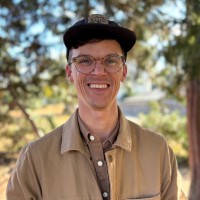
Josh Murphy
AeroLeads people directory · profile

Josh Murphy Email & Phone Number

Program Manager with NOAA; Adjunct Faculty, Georgetown URP at NOAA Office for Coastal Management
Location: Rockville, Maryland, United States 7 work roles 1 school
1 work email found @noaa.gov 1 phone found area 202 LinkedIn matched
✓ Verified August 2026 4 data sources Profile completeness 100%

Contact Signals · 1 work email · 1 phone

Work email j****@noaa.gov
Direct phone (202) ***-****
LinkedIn Profile matched
3 free lookups remaining · No credit card
Role
Program Manager with NOAA; Adjunct Faculty, Georgetown URP
Location
Rockville, Maryland, United States
Company size

Who is Josh Murphy? Overview

A concise factual answer block for searchers comparing this professional profile.

Quick answer

Josh Murphy is listed as Program Manager with NOAA; Adjunct Faculty, Georgetown URP at NOAA Office for Coastal Management, a with 6277 employees, based in Rockville, Maryland, United States. AeroLeads shows a work email signal at noaa.gov, phone signal with area code 202, and a matched LinkedIn profile for Josh Murphy.

Josh Murphy previously worked as Learning Product Development Program Manager at Noaa Office For Coastal Management and Senior Coastal Information Specialist at Noaa Office For Coastal Management. Josh Murphy holds Bachelor’S Degree, Geography from Penn State University.

Company email context

Email format at NOAA Office for Coastal Management

This section adds company-level context without repeating Josh Murphy's masked contact details.

jmurphy@noaa.gov
79% confidence

AeroLeads found 1 current-domain work email signal for Josh Murphy. Compare company email patterns before reaching out.

Profile bio

About Josh Murphy

I’ve worn many hats during my two decades of service to the NOAA Coastal Services Center and Office for Coastal Management. However, one aspect of my career has remained constant - a focus on developing products and services that provide place-based information to coastal communities. This has taken many forms: from the development and delivery of in-person classes that integrate geospatial tools and methods with coastal issues, to the leadership of teams that develop web-based mapping tools. I like to characterize my role as an “information broker”. I work with local communities to better understand their information needs and then leverage collaborative partnerships and teams to co-develop products that provide targeted information to address these needs. Increasingly, these products incorporate learning concepts and methods to ensure that they are flexible and adaptable in their approach to address local-level issues such as community resilience.Specialties: geographic information systems (GIS), spatial analysis, project management, curriculum development and instruction

Listed skills include Spatial Analysis, Gis, Arcgis, Spatial Databases, and 29 others.

Current workplace

Josh Murphy's current company

Company context helps verify the profile and gives searchers a useful next step.

NOAA Office for Coastal Management
Noaa Office For Coastal Management
Program Manager with NOAA; Adjunct Faculty, Georgetown URP
washington, district of columbia, united states
Website
Employees
6277
AeroLeads page
7 roles

Josh Murphy work experience

A career timeline built from the work history available for this profile.

Learning Product Development Program Manager

Current

Silver Spring, Maryland, United States

In my current role, I lead the Learning Product Development (LPD) Program within the NOAA Office for Coastal Management's Learning Services Division. This includes the following roles and responsibilities:• Serving as a supervisor to a talented cadre of federal staff within the program• Providing guidance and direction to Federal Project Leaders as they plan for and execute projects that encompass instructional design and technologies, natural and nature-based solutions, risk communication, and community planning for resilience. • Developing and implementing a long-term strategic direction for the Digital Coast Academy - the Office for Coastal Management's platform for providing access to learning products and services.In addition to these LPD tasks and activities, I also serve as the federal lead for the redevelopment of the Digital Coast web platform, and the Digital Coast Partnership.

Jun 2022 - Present

Senior Coastal Information Specialist

Silver Spring, Md

In this position, I primarily supported federal efforts directed at enhancing the resilience of our nation's coastal landscapes, populations, and infrastructure. This included:• Serving as a member of the federal leadership team during the development of the reimagined Coastal County Snapshots product. I also led the content development for a new snapshot on sea level rise.• Serving as the federal project lead for the development of Adapting Stormwater Management for Coastal Floods, an innovative web-based learning product that provides guidance and methods for coastal stormwater managers to develop future coastal total water levels. • Serving as the Co-Lead of the U.S. Committee on the Marine Transportation System (CMTS) Resilience Integrated Action Team. Recently, the team has developed three reports outlining challenges and best practices for federal agencies charged with MTS response and recovery operations during the 2017, 2018-2019, and 2020 hurricane seasons. • Serving as the primary point of contact between NOAA and the Urban Land Institute, and as co-point of contact with the American Planning Association in support of the Digital Coast Partnership. • Serving on a two-year rotational assignment to the U.S. Department of Housing and Urban Development (HUD), where I led a cross-agency team in the development of HUD's initial Climate Adaptation Plan in response to Executive Order 13514 and identified opportunities to integrate NOAA data and information into HUD programs.• I was frequently asked by Office for Coastal Management, National Ocean Service, and NOAA leadership to represent the organization in briefings on the Digital Coast and NOAA’s coastal resilience portfolio. The audience of these briefings included: other federal agencies, such as FEMA, USDOT, USACE; Congressional offices; non-governmental organizations, such as the U.S. Chamber of Commerce; and private sector partners, such as the Dewberry Resilience Technical Leaders Focus Group.

Jun 2011 - Jul 2022

Lecturer

Current

Washington D.C. Metro Area

I hold an adjunct faculty position within the Urban and Regional Planning program, where I teach Geographic Information Systems (GIS) tools and concepts within the following classes:MPUP 520 - Methods in Urban Planning Research and Analysis. In this team-taught course, I teach three class sessions on spatial data visualization and mapping using the ArcGIS Online platform. MPUP 605 – Introduction to Geographic Information Systems. I developed this course to provide an in-depth overview of web-based GIS tools and their application to urban planning concepts. This class has been co-listed with the Real Estate Program and has included students from the McCourt School of Public Policy.MPUP 610 – Advanced Applications of GIS. This course was developed to address student requests to go deeper into the geospatial analysis process. This class focuses on the ArcGIS Pro desktop software package and incorporates advanced geospatial techniques, to include Python scripting and geostatistical analysis methods. In partnership with the Emergency and Disaster Management Program, I developed a series of asynchronous GIS modules that demonstrate the application of the ArcGIS Online platform to emergency management issues.

Aug 2013 - Present

Digital Coast Project Manager

Charleston, Sc

The Digital Coast (https://coast.noaa.gov/digitalcoast) is a partnership and web-based platform focused on the application of geospatial information to coastal management issues. As Project Manager, I was responsible for the following:• Development and implementation of an organizational structure for the Digital Coast effort that effectively leveraged staff expertise and perspectives from a variety of Center program areas• Development and execution of annual plans to guide project activities across dedicated teams of federal and contract staff supporting the Digital Coast effort• I provided leadership and guidance to the Digital Coast Web Team, as we developed and executed a plan to strategically grow and enhance the Digital Coast website to incorporate user-specified enhancements. During my tenure as project manager, the Digital Coast site grew from less than 10 web pages, to a comprehensive information repository that includes hundreds of pages that link coastal managers to data, tools, training, and case studies. • Worked with NOS headquarters to develop a Digital Coast-themed performance measure in support of the Department of Commerce's Balanced ScoreCard initiative• Provided briefings on the Digital Coast and its associated geospatial information products and services to various audiences, including: NOAA and Department of Commerce leadership, the National Geospatial Advisory Committee, the International Coastal Atlas Network, and the Inter-Agency Working Group on Ocean and Coastal Mapping.

Oct 2007 - Jun 2011

Senior Spatial Analyst / Technical Program Leader

Charleston, Sc

I provided support to the GIS Integration and Development Program at the NOAA Coastal Services Center through the following tasks and initiatives:• Served as a Technical Program Leader for the GIS Integration and Development Program. Provided leadership and oversight to all contract project teams working on GIS decision support tools, geospatial training, marine boundary development, and shoreline data development projects; reviewed contract project implementation plans, deliverable, and monthly reports; and provided input into annual planning processes. • Developed expanded guidance and training in project management for contract staff• Provided technical oversight and leadership to the development of a Management Information System (MIS) for the NOAA Coastal Services Center. Worked with Center management to develop an automated system for project planning and execution.• Led the development of “GIS Tools for Strategic Conservation Planning”, with The Conservation Fund. This resulted in a 4-day intermediate level GIS course focusing on the integration of green infrastructure network design concepts with spatial analysis tools and methods.

Sep 2005 - Oct 2007

Spatial Analyst

Charleston, Sc

I provided support to the GIS Integration and Development Program at the NOAA Coastal Services Center through the following tasks and initiatives:• Served as Project Leader for the development of several coastal and marine decision support tools. These included: the Benthic Terrain Modeler (BTM), a collection of ArcGIS-based tools that coastal and marine resource managers can use, with bathymetric data sets, to examine the deep-water benthic environment; and the Chesapeake Bay Oyster Larvae Tracker (CBOLT), an integrated system of components that allows users to control a particle tracking model, and then examine the output as geospatial features in a Web-based map interface. In each case, I worked closely with external project partners to develop customized technical solutions that address place-based coastal and marine management issues.• As an ESRI-authorized instructor, I taught "Introduction to ArcGIS I" and the Center-developed "Coastal Applications of ArcGIS" courses to over 350 students within the coastal resource management community• Provided technical leadership to the development of several Center efforts to visualize coastal management issues in 3D. This included the implementation of new dock and pier regulations in Massachusetts, and the visualization of potential storm surge impacts in Brevard and Volusia Counties in Florida. • Provided technical support to Federal Geographic Data Committee’s Marine Boundary Working Group. In this role, I worked with inter-agency project teams to develop and refine a process for marine boundary development using GIS software

Sep 2003 - Aug 2006

Gis Technician

Charleston, Sc

I provided support to the GIS Integration and Development Program at the NOAA Coastal Services Center through the following tasks and initiatives:• Served as Project Leader for the Pacific Islands GIS project, a large, multi-agency initiative to increase the spatial data capacity of the U.S. Flag territories in the Pacific Ocean• Led the development of “Coastal Applications of ArcGIS”, a three-day intermediate-level GIS training course focusing on the integration of ArcGIS technology and coastal resource management issues• Developed and taught technical training on GPS and metadata specifically designed to meet the educational and cultural needs of the Territories of Guam and American Samoa, the State of Hawaii, and the Commonwealth of the Northern Mariana Islands

Jan 2002 - Sep 2003
Team & coworkers

Colleagues at NOAA Office for Coastal Management

Other employees you can reach at noaa.gov. View company contacts for 6277 employees →

1 education record

Josh Murphy education

FAQ

Frequently asked questions about Josh Murphy

Quick answers generated from the profile data available on this page.

What company does Josh Murphy work for?

Josh Murphy works for NOAA Office for Coastal Management.

What is Josh Murphy's role at NOAA Office for Coastal Management?

Josh Murphy is listed as Program Manager with NOAA; Adjunct Faculty, Georgetown URP at NOAA Office for Coastal Management.

What is Josh Murphy's email address?

AeroLeads has found 1 work email signal at @noaa.gov for Josh Murphy at NOAA Office for Coastal Management.

What is Josh Murphy's phone number?

AeroLeads has found 1 phone signal(s) with area code 202 for Josh Murphy at NOAA Office for Coastal Management.

Where is Josh Murphy based?

Josh Murphy is based in Rockville, Maryland, United States while working with NOAA Office for Coastal Management.

What companies has Josh Murphy worked for?

Josh Murphy has worked for Noaa Office For Coastal Management, Georgetown University School Of Continuing Studies, Noaa Coastal Services Center, I. M. Systems Group Inc. (Imsg), and Perot Systems Government Services.

Who are Josh Murphy's colleagues at NOAA Office for Coastal Management?

Josh Murphy's colleagues at NOAA Office for Coastal Management include Tammy Muncy, Steve Morton, Annie Thomson, Derek Babb, and Kevin Gilmore - Noaa Federal.

How can I contact Josh Murphy?

You can use AeroLeads to view verified contact signals for Josh Murphy at NOAA Office for Coastal Management, including work email, phone, and LinkedIn data when available.

What schools did Josh Murphy attend?

Josh Murphy holds Bachelor’S Degree, Geography from Penn State University.

What skills is Josh Murphy known for?

Josh Murphy is listed with skills including Spatial Analysis, Gis, Arcgis, Spatial Databases, Geomatics, Geography, Remote Sensing, and Cartography.

Find 750M verified contacts

Search by job title, company, industry, location, and seniority. Export verified B2B contact data when you need it.

People with similar names

Check these profiles if this is not the Josh Murphy you were looking for.

View similar profiles